
We have a tradition in my father’s family of having special food at Christmastide. They hailed from Nottinghamshire, Britain. A bowl of hot boiled wheat porridge called frumenty was made only for Christmas time. This ancient pottage hails from the middle ages and my version bears some resemblance to the medieval frumente. My Dad always called it frummedy.
I found this description of frumety in A Dollop of History…. “The Saxons of Britain had access to wheat but ate significantly more barley. The Normans, however, tended to eat richer foods and preferred to use wheat over other grains. Throughout the high and late medieval eras, frumenty became a staple food, especially in upper-class households and at royal banquets. The dish was considered lavish enough to mention in the 14th-century poem… By the 13th century these recipes were finally being written down and preserved for future generations. Wheat was widely available throughout all of Europe, but was the most desirable grain so peasants were forced to gravitate toward other less-expensive options like millet.”
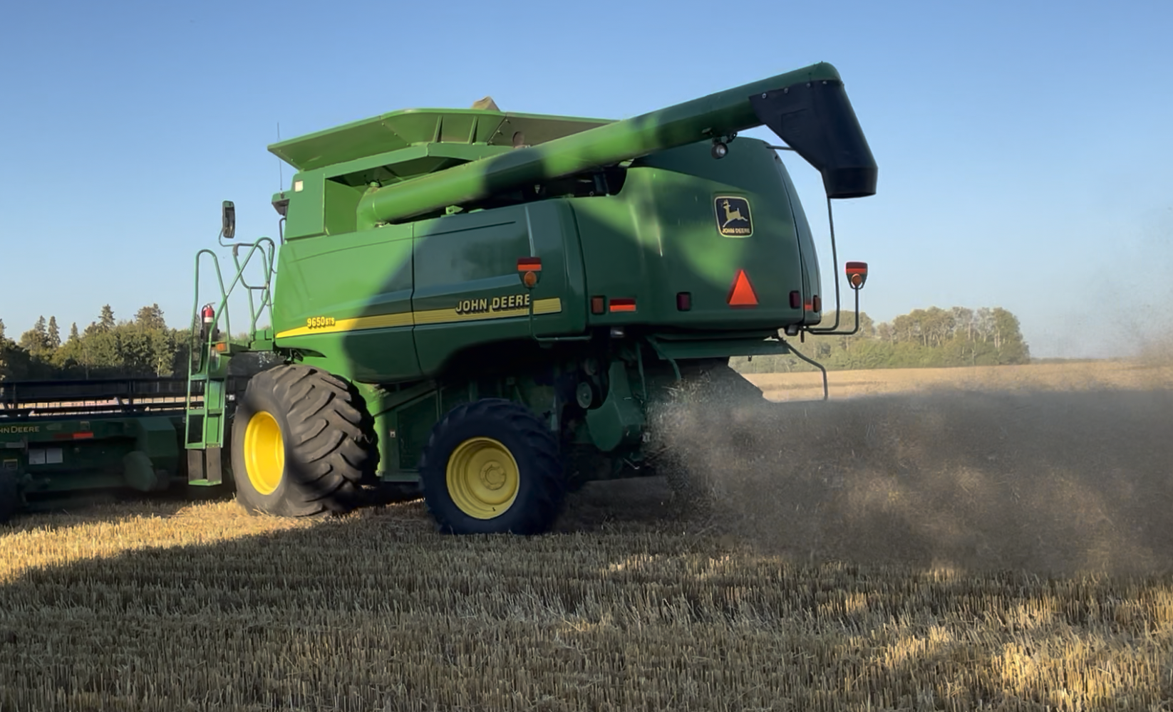
I still make frumenty every Christmas. This year it got even more special because the hard wheat I used came directly out of a newly combined field and strait into my hand this past September.

I was privileged to spend some time with a dear friend in the Swan River Valley. She is married to a third generation farmer of the long-standing Cotton family. Her husband is the grandson of A.J. Cotton, famously known as The Wheat King. And it was from a field right behind this very Cotton farmhouse that the wheat in my hand was harvested from.

Here’s a long interesting aside. The Swan River Valley is beautiful and near Benito is an especially significantly indigenous mound called Thunder Hill. Quoting Jonathan J. Kalmakoff (Dukabor Heritage)…
“Thunder Hill is a large, isolated glacial mound formed during the Pleistocene Age that straddles the Saskatchewan-Manitoba border near Benito, Manitoba. Seven kilometers in length and four kilometers in width, it rises 532 meters (1,500 feet) above the flat surrounding plain. The hill slopes gently to the north-westward, while to the south-eastward there is an abrupt escarpment broken by successive landslides, which are now separated from each other by small valleys. Historically, it was densely covered with large stands of burr oak and birch, although in recent decades, the most southwesterly portion has been cleared and cultivated. The hill strikes a dramatic contrast in relief and has been a prominent landmark among local people over the ages.
The English name of the hill has been in use since 1691, when English fur trader and explorer Henry Kelsey met with Assiniboine Indians from Thunder Hill. A century after, a British surveyor, map-maker, fur trader and explorer Peter Fiddler visited Thunder Hill and mapped it in 1795. Two years later, British-Canadian fur trader, surveyor and explorer David Thompson visited Thunder Hill in 1797 and later mapped it in 1814.
Most scholars agree that the name is an English translation of a much older Assiniboine name given to it by First Nations people of the area. Some speculate that they gave it this name because they believed the Great Spirit manufactured the lightning and thunder in it, for when there was much lightning it seemed to flash all around and over the hill, and First Nations people would not go near the hill in a storm. Others suggest the name is a short form of Thunder Bird Hill, after the thunderbird of indigenous mythology – a supernatural being of power and strength.
In 1899, the Dominion Government of Canada reserved a large block of 7 townships (1008 quarter-sections or 161,280 acres) of land surrounding the north, west and south slopes of Thunder Hill for the exclusive use of Doukhobor immigrants from Russia. in the vicinity of Thunder Hill for the exclusive use of Russian Doukhobor immigrants. Over the next 19 years until its final cancellation in 1918, the reserve was known by Doukhobors and Land Branch officials alike as the ‘Thunder Hill Colony’ after the prominent landmark.
Indeed, many of the 1,392 Doukhobors who first settled in the Thunder Hill Colony in 1899 spent their first winter living in earthen dugout shelters excavated into the north, west and south slopes of the hill. They would go on to establish 16 Old World villages in the colony, many within sight of the hill.
The Doukhobors themselves called the hill Gromovaya Gora (Громовая гора), which was a literal Russian translation of the pre-existing English place name. In 1906, one of several new Doukhobor villages established west of the hill was also named Gromovoye, after the landmark.
For the Doukhobors of the Thunder Hill Colony, it became a summertime ritual to climb Gromovaya Gora to gather bundles of small leafy branches from the burr oak trees growing at its top. The bundles were tied together to form crude brooms, known as dubovye veniki, for use in their banyas (‘steam bath houses’) to gently strike the skin to open pores and to direct steam. Oak was prized by the Doukhobors for making veniki because of its rich and deep aroma, and the anti-inflammatory qualities of its leaves. As it could only be found atop the hill, this added to its special significance among them.
Upon arriving in Canada from Russia to lead the Doukhobors in December 1902, Peter Vasil’evich Verigin was at once struck by the natural beauty and almost mystical quality of the hill. By April 1903, he announced plans to establish a communal park on its slopes, in the centre of which the Doukhobors would erect a meeting house where religious services would be held and where he would reside, which was to known as Sion (Сион), meaning ‘Zion’. This Biblical place name held especial significance for the Doukhobors and was used as a synonym for the place where Doukhobor leaders resided as well as for the Doukhobor faith as a whole.
Ultimately, Verigin was unable to secure land rights to the top of the hill, which was not yet opened to homestead entry. Consequently, his residence was built later that year at Otradnoye village near Veregin instead. However, the Doukhobor leader never completely abandoned his hope of establishing Sion at Gromovaya Gora. As late as October 1906, Verigin was still petitioning the Minister of Interior, Frank Oliver, to be allowed to occupy the lands atop the hill.
As the north base of Thunder Hill contained a large deposit of clay suitable for brick-making, in 1903, the Doukhobors established a steam-operated brickworks close by on the Northeast Quarter of Section 28, Township 35, Range 30, West of the 1st Meridian. The Thunder Hill brick yard operated for 6 years, employing 25 Doukhobor labourers. The bricks were used by the Doukhobors to build village structures with excess bricks sold commercially in nearby Swan River.
Meanwhile, the English name for the hill lent itself to a number of places in the surrounding vicinity.
Between 1899 and 1908, Doukhobors of the Thunder Hill Colony formed the majority of the labour force used to construct the Canadian Northern Railway’s branch line generally known as the ‘Thunderhill Branch’ which ran east of the hill from Swan River to Thunderhill Junction, Durban and Benito, then south and west of the hill through Arran, Pelly, Norquay, Hyas, Stenen and on to Sturgis.
In April 1900, Thunder Hill Post Office was established on Section 10, Township 35, Range 29, West of the 1st Meridian, where it operated until July 1944. A year later, in July 1901, Thunder Hill School was established on the Northeast Quarter of Section 21, Township 35, Range 29, West of the Meridian, where it operated until 1967. Both served the English Canadian settlers on the east (Manitoba) slope of the hill.
By 1907, a tributary stream of the Swan River running along the south slope of the hill appeared in maps as Thunderhill Creek; although it would be 33 years before the name was officially recognized by government authorities in 1940.
In 1912, Thunder Bird School District No. 762, a variant name, was established just south of Thunder Hill and Thunderhill Creek on the Northwest Quarter of Section 1, Township 35, Range 30, West of the First Meridian. A large number of Doukhobor children attended this school throughout the early 20th century.
In 1913, those Doukhobors belonging to the Christian Community of Universal Brotherhood abandoned the Thunder Hill district and relocated en masse to British Columbia. However, hundreds of Independent Doukhobors remained on homesteads surrounding the north, west and south slopes of the hill, which they continued to call Gromovaya Gora well through the Fifties and Sixties. Many of their descendants continue to live and farm near the hill to this day.”

The Cotton Farm is slightly to the east of Thunder Hill. And A. J. Cotton is buried not far from here.

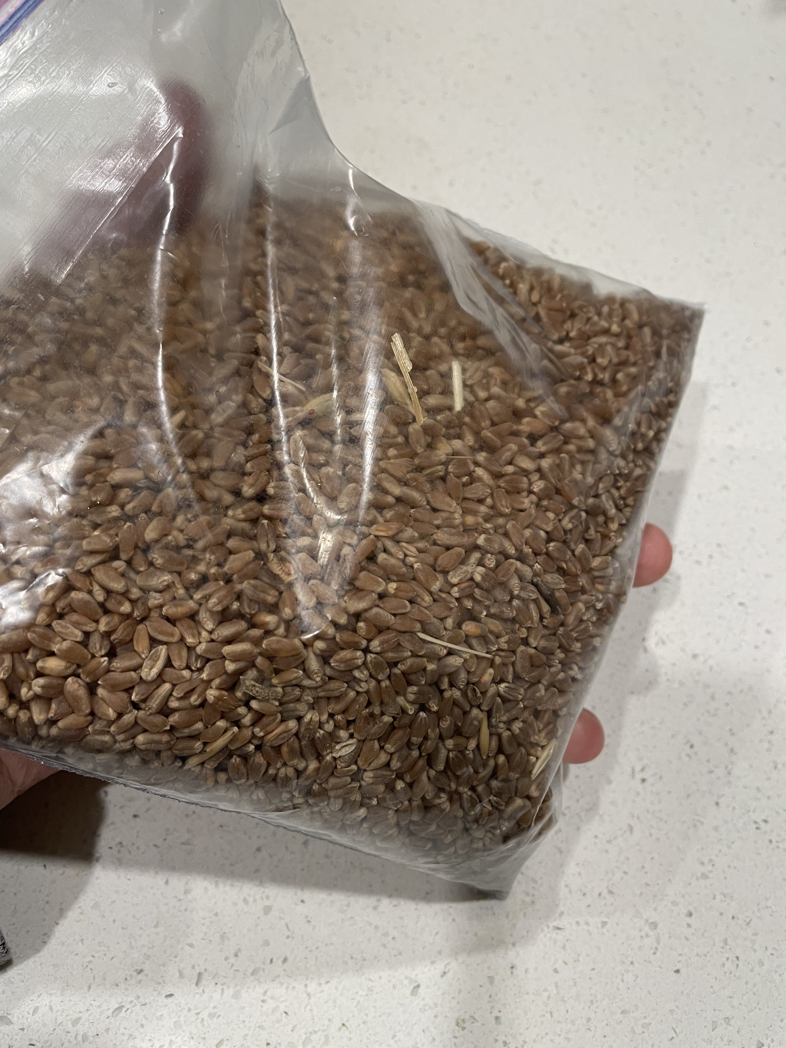
So lucky me, not a peasant, I get fresher than fresh hard wheat grown in historic fields for my nearly 2000 year old Christmas treat.

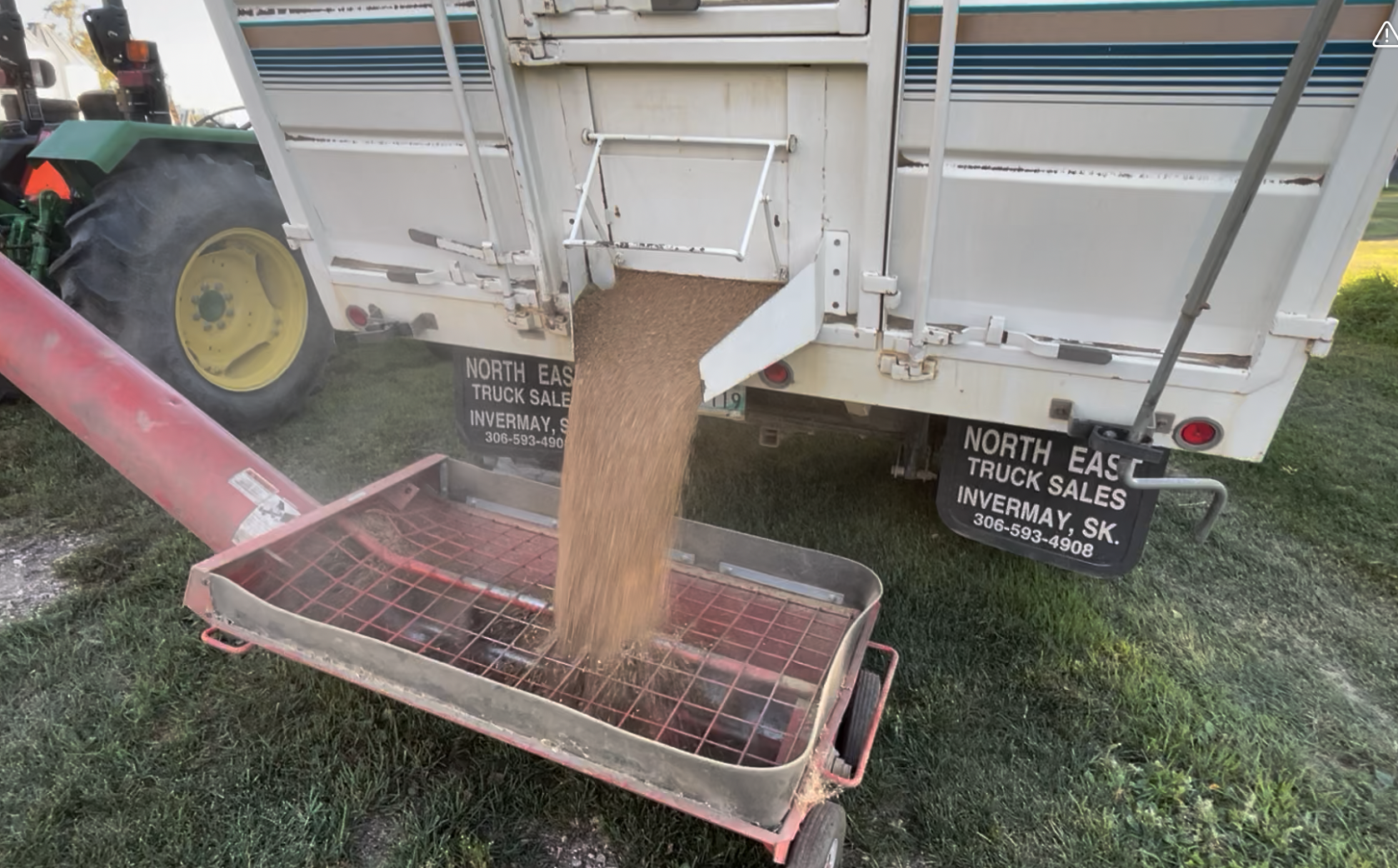
Cleaning the wheat

My yummy frumety. Served with heaps of brown sugar and fresh cream, this is the taste of Christmas morning since my childhood.


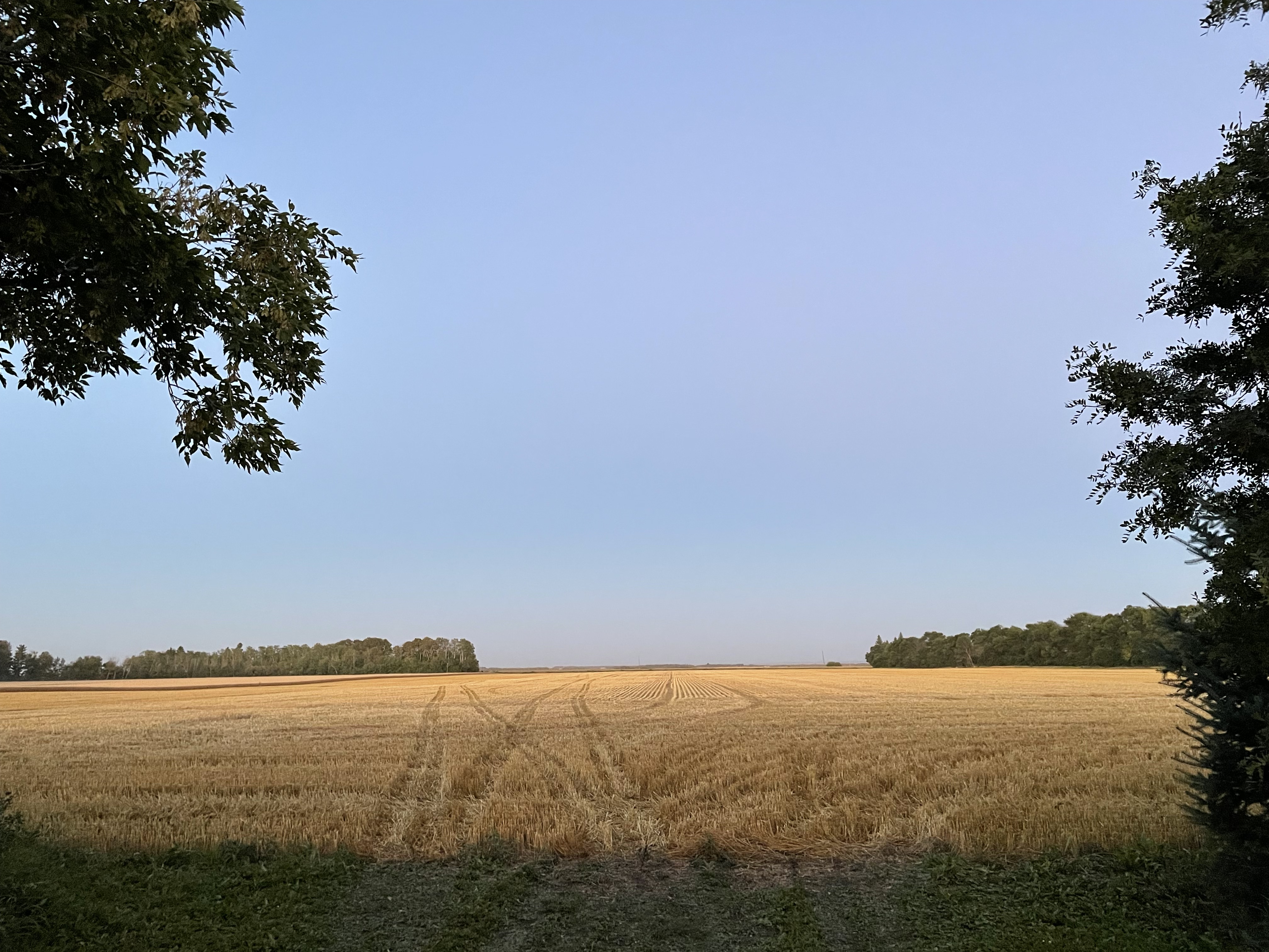
Sunset behind Thunder Hill.


What did this post stir up in you?